
Where Is This Beach? How to Find a Beach From a Photo
By Sam D. · · 7 min read
Short answer
To work out where this beach is, check the photo file for GPS first. Then read the coast itself: sand color, rock formations, water color, plants, lifeguard flags and signs. Use those clues to pick a region, match the shape of the coastline in satellite view, and confirm the beach with a reverse image search.
Find where your photo was taken
Upload a photo: GeoSpy AI reads its GPS data if it has any, and otherwise estimates the place from what it shows.
Beach photos look interchangeable at first: sand, water, sky. Yet a coast holds evidence that is hard to fake. The color of the sand, the rock behind it, the plants above the tide line, the lifeguard equipment and the way the water moves all belong to particular parts of the world. If you would rather start from an estimate, an AI photo locator reads the same clues in seconds; the steps below show how to check it.
This guide covers what is special about beaches. For the general method that works on any picture, see how to find where a photo was taken. For mountains, valleys and other inland scenery, use the landscape photo guide.
Does the beach photo have GPS data?
Check the original file first. Phones save GPS coordinates in the photo when location is on, and a metadata viewer shows them in seconds. Copies saved from social apps have usually lost them, so ask for the original file or move on to the clues in the picture.
Open the original in a photo metadata viewer and look for latitude and longitude. If they are there, check that the map point is actually on a coast that looks like the picture, because a photo edited or exported later can carry another photo’s data. If the fields are empty, the file was probably shared through an app that strips them; our guide to why photos lose location when shared explains which ones do.
What can the sand tell you about the beach?
Sand color narrows the region fast. White coral sand points to tropical reefs, black sand to volcanic coasts such as Hawaii, Iceland or the Canary Islands, and pink sand to a few beaches like those in Bermuda. Golden quartz sand is found almost everywhere, so treat it as neutral.
- Bright white, fine sand usually comes from broken coral and shells, which means warm water and reefs nearby: the Caribbean, the Indian Ocean, the South Pacific.
- Black sand forms where lava meets the sea and shatters, as on Hawaii’s Punaluʻu Beach, or where heavy dark minerals collect. Iceland, the Canary Islands, the Azores and parts of New Zealand have well-known examples.
- Pink or reddish sand gets its tint from tiny red shells mixed with white sand. It is rare enough that it shortens the list to a handful of places.
- Pebbles and shingle mark coasts where waves and rivers bring stones rather than sand: much of England, the French Riviera around Nice and many Adriatic coves.
- Golden quartz sand is the default almost everywhere. It rules little in or out on its own.
Which rocks and cliffs give a coastline away?
Rock is the most distinctive clue on many beaches. Golden limestone arches and sea stacks, black basalt columns, smooth granite boulders and white chalk cliffs each belong to particular coasts. Match the rock first, then look for the specific formation.
| What you see | Where it is typical |
|---|---|
| Golden limestone cliffs, arches and sea stacks | Algarve (Portugal), Victoria’s Great Ocean Road (Australia), parts of Malta and southern Spain |
| Black basalt columns | Northern Ireland, Iceland, the Faroe Islands, volcanic islands |
| Smooth gray or pink granite boulders | The Seychelles, Sardinia, Corsica, parts of Thailand |
| White chalk cliffs | Southern England, Normandy (France), the island of Rügen (Germany) |
| Red sandstone cliffs | Prince Edward Island (Canada), Devon (England), parts of Western Australia |
Once you know the rock, the shape of the formation often settles it. A single arch, a pair of stacks or a cave mouth is like a fingerprint: few coasts have the same outline. Search for the formation with the region name and compare the photos that come back.
How do lifeguard flags, towers and umbrellas help?
Beach safety equipment follows national rules. Red-and-yellow flags mark the patrolled zone in Australia, New Zealand and the UK; lifeguard towers look different from city to city; Mediterranean beaches are often lined with numbered rows of rented umbrellas. Signs add a language and often a town name.
Look at everything that people installed on the sand. The color and shape of a lifeguard tower can identify a city on its own, and a row of matching sunbeds under branded umbrellas belongs to a beach club whose name is often printed on them. Warning signs, bins, showers and boardwalk railings carry language, script and municipal styles. The more ordinary the object, the more reliable it is, because nobody stages a trash can for a photo.
What do the water and the tide say?
Water color and tide marks point to a type of sea. Turquoise shallows over white sand suggest the tropics, dark gray-green water a cold coast. A wide wet beach with seaweed far below the dunes means a large tidal range, while the Mediterranean barely has tides.
Tides differ enormously between seas. The Bay of Fundy in Canada has a tidal range of about 16 meters, while the worldwide average is about one meter. A photo showing boats lying on wet sand, or a huge flat beach at low tide, rules out enclosed seas with almost no tide. Waves help as well: long rolling surf points to an open ocean coast, flat water to a bay, a lagoon or a sheltered sea.
How do you confirm which beach it is?
Turn the clues into a short list of candidate coasts, then match the outline of the beach in satellite view: headlands, offshore rocks, river mouths and buildings. A reverse image search and Street View along the promenade confirm the exact spot.
- Step 1Write down the cluesSand, rock, water, vegetation, equipment and any text. Note which ones you are sure of.
- Step 2Pick candidate coastsKeep only the regions where all the strong clues agree, then list beaches there that people photograph.
- Step 3Match the outline from aboveIn Google Earth or a satellite map, compare the shape of the bay, the headlands and any offshore rocks with the photo.
- Step 4Search with imagesRun the picture through a reverse image search; popular beaches are photographed thousands of times, so a match is likely.
- Step 5Stand where the photographer stoodUse Street View or published photos from the candidate beach to find the viewpoint and confirm it.
Can AI tell where a beach photo was taken?
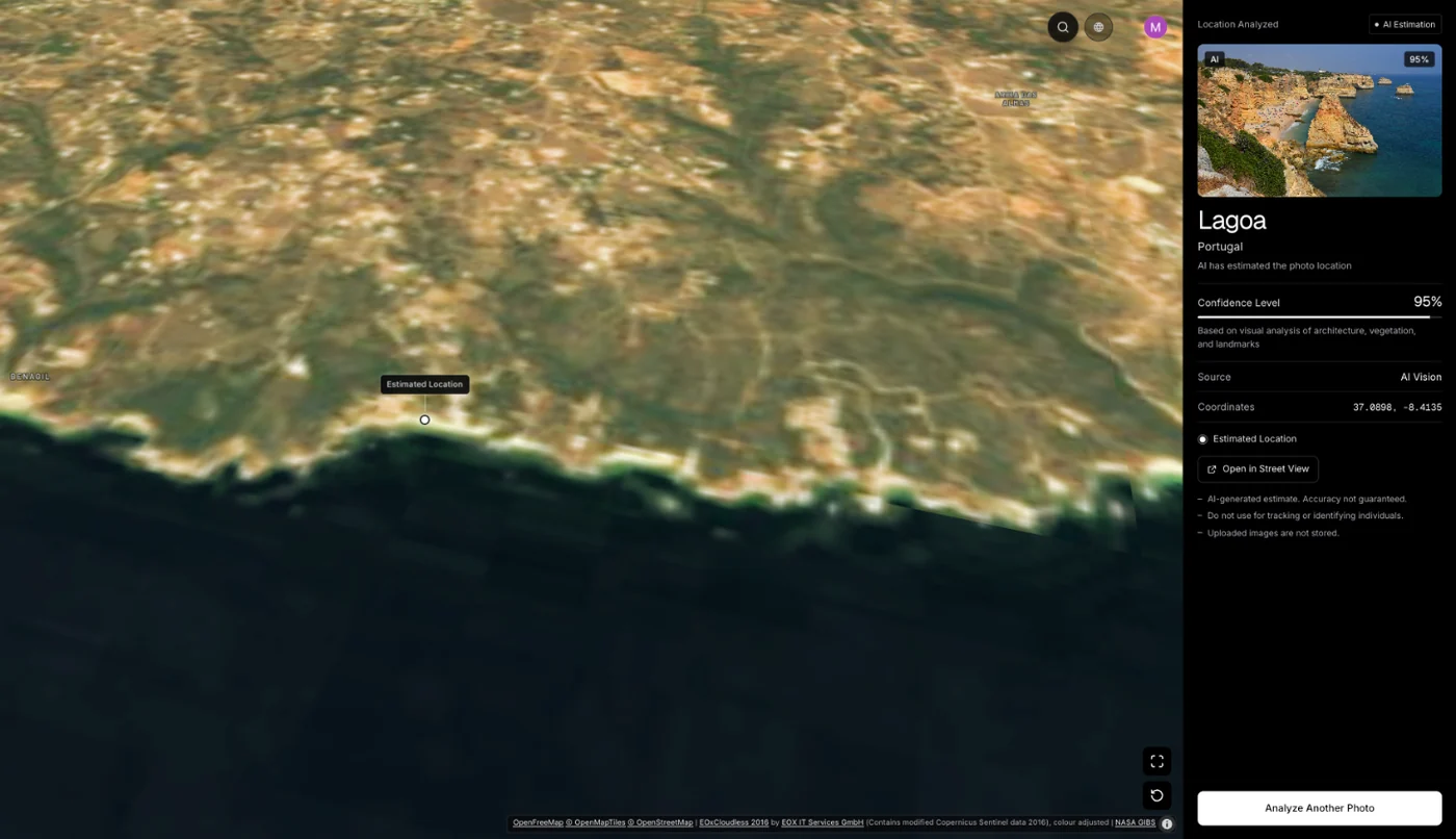
It can estimate it. GeoSpy reads GPS from the file when it is there; without it, an AI model estimates the place from the coastline, rock, vegetation and buildings, and returns a location with a confidence score on a map. Use the answer as a lead and confirm it with the steps above.
An AI estimate is most useful at the start, when you have no idea which continent you are looking at. Upload the picture and check the result against the clues you listed: if it names a limestone coast and your photo shows limestone arches, you have a strong lead to confirm on the map. Seeing the full result is a paid feature on the web. For how such models read a scene, see how AI geolocation works.
Frequently asked questions
- How can I find out which beach is in a picture?
- Look for GPS in the original file, then read the sand, rock, water and anything people installed on the beach. Use the clues to choose a coast and match the shape of the beach in satellite view.
- Can Google Lens identify a beach?
- Often, for popular beaches, because many people have photographed the same view. For a small or private stretch of coast it tends to return similar-looking beaches, so combine it with clue reading.
- Why do some beaches have black or pink sand?
- Black sand comes from volcanic rock broken up by the sea or from heavy dark minerals. Pink sand gets its color from fragments of red shells. Both are rare enough to shorten the list of places a lot.
- Can I find a beach from an Instagram photo?
- Yes. Check the post’s location tag and caption first, then use the clues in the picture. Our guide to finding where an Instagram photo was taken covers the platform side.
- Can the sun tell me which hemisphere a beach is in?
- Sometimes. Shadows point roughly away from the equator around midday, so their direction can hint at the hemisphere. Our guide to finding location from shadows explains the method.
Sources
- Bay of Fundy — WikipediaTidal range of about 16 meters, against a worldwide average of about one meter.
- Black sand — WikipediaHow lava meeting the sea produced Hawaii’s black sand beaches, such as Punaluʻu.
- Surf lifesaving — WikipediaThe patrolled area of a beach is marked out with red and yellow flags; swimmers are asked to stay between them.
- Praia da Marinha — WikipediaA limestone beach in Lagoa, Algarve, listed by the Michelin Guide among the 100 most beautiful beaches in the world.
Keep reading
How to Find Where a Landscape Photo Was Taken
Where was this landscape photo taken? Identify peaks with PeakFinder or PeakVisor, read sun, shadows and vegetation, then match the view in Google Earth 3D.
· 6 min read
How to Find Out Where a Photo Was Taken
Four ways to work out where a photo was taken: GPS metadata, reverse image search, AI geolocation and reading the image itself. What each can and cannot do.
· 7 min read
How to Find Location From Shadows in a Photo
Shadows will not give you a country, but they settle hemisphere, time of day and season — which is often exactly what separates two candidate answers.
· 4 min read
We Tested an AI Photo Location Finder on 50 Photos (2026)
AI photo location finder accuracy, tested on 50 public photos with known spots: 90% landed within 25 km, 66% within 1 km. Every answer, misses included.
· 11 min read